The Ohio River
The Adventure...
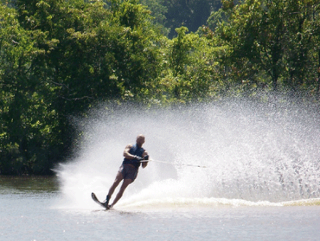
The Ohio River is known for being a great water recreation area. Boaters can travel on the Ohio River through Meigs County for 34 unrestricted miles. Popular activities include boating, jet skiing, water skiing, and fishing
11 access points in Meigs County:
Apple Grove Access - State Route 338 at Apple Grove, Ohio.
Click HERE to view the map.
Forked Run Public Ramp - Off State Route 124, 4 miles west of Reedsville, Ohio.
Click HERE to view the map.
Leading Creek Ramp - North Front Street and Oak Street off State Route 7, Middleport, Ohio.
Click HERE to view the map.
Middleport City Ramp - Corner of First Ave. and Walnut Street, Middleport, Ohio.
Click HERE to view the map.
Old Lock 24 Campgrounds, Fuel, and Ramp - State Route 124, Racine, Ohio.
Click HERE to view the map.
Portland Access - Off State Route 124, 2 miles north of Portland, Ohio.
Click HERE to view the map.
Racine City Ramp - 3rd Street to Main Street turn right, Racine, Ohio.
Click HERE to view the map.
Racine (Tailwater) - State Route 338, 5 miles south of Racine, Ohio.
Click HERE to view the map.
Riverside Amphitheater Courtesy Dock - East Main Street, Pomeroy, Ohio.
Click HERE to view the map.
Shade River Access - Mouth of Shade River, off State Route 124, 2 miles north of Long Bottom, Ohio.
Click HERE to view the map.
Syracuse City Ramp - Bridge Street to Marina Drive off State Route 124, Syracuse City Park, Syracuse, Ohio.
Click HERE to view the map.
Learn More!
Meigs County Tourism
238 West Main Street
Pomeroy, Ohio 45769
740.992.2239
740.949.7039
E-mail: [email protected]
238 West Main Street
Pomeroy, Ohio 45769
740.992.2239
740.949.7039
E-mail: [email protected]
Getting there is Half the Adventure!
The Ohio River forms Meigs County’s eastern border. The river can be accessed from a variety of places listed above
